University of Toronto Develops New LiDAR System Capable of Measuring Position, Velocity, and Material Properties in a Single Measurement
According to foreign media reports, researchers at the University of Toronto have developed a new type of LiDAR system that can simultaneously measure the position, velocity, and material properties of objects in a scene. This type of information has broad application value in fields such as robotics, autonomous driving, and remote sensing.
LiDAR uses laser pulses to measure distance and construct high-precision three-dimensional maps of objects and terrain. However, most commercial LiDAR systems, such as those used in autonomous vehicles, are primarily designed to measure distance.
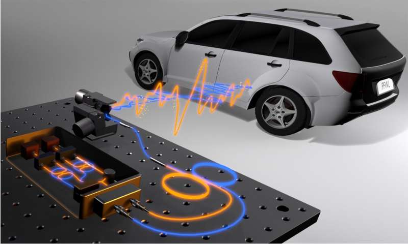
"Although some emerging LiDAR technologies can also measure velocity, practical environmental perception often requires understanding the surface properties of objects," said Dongyu Du from the University of Toronto in Canada. "Our new system requires only a single measurement per scanning point to obtain millimeter-level precision in distance, velocity, and surface material information while ensuring the laser power is safe for the human eye."
Researchers from the University of Toronto and the networking technology company Ciena Corporation introduced this new LiDAR system in the journal *Optica*. The system combines innovative analytical methods with standard telecommunications equipment to capture polarization information, thereby sensing distance, velocity, and surface material properties.
Du stated: "Although this work is still in the research prototype stage, it points the way for future sensing systems, potentially helping machines understand the physical world more reliably. This could make autonomous vehicles safer, improve robot performance, enhance industrial inspection, and enable sensing systems to operate effectively under poor visibility conditions such as strong glare, heavy fog, or torrential rain."
Comments
0 comments